All the photos featuring the aircraft are screenshots in the simulator. There is a camera in the cockpit and a drone camera that follows the aircraft. The video of each flight is an edited version of highlights of about 5 minutes duration. |
|
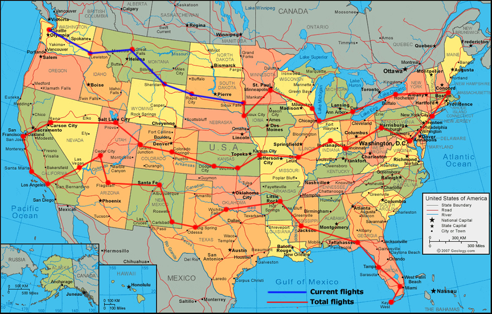
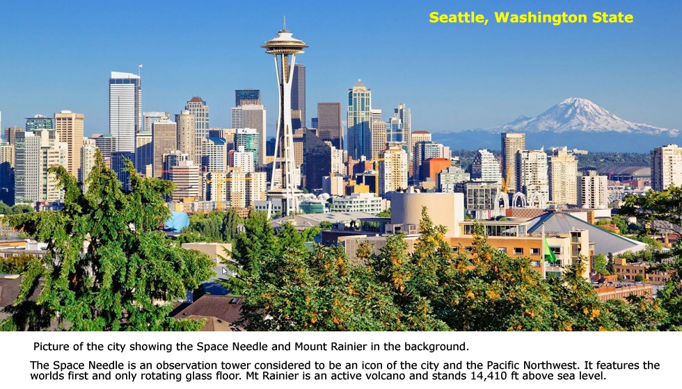
This is the flight from Seattle to Lewiston on 28/6/21 in the Citation Longitude business jet. |
|
 |
|
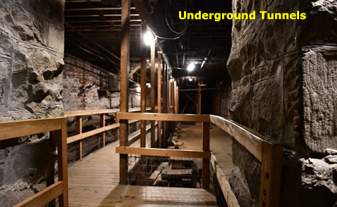 |
Underground tunnels. The city was burned to the ground in 1889. It was rebuilt on top of the old to overcome drainage issues of the old city. You can walk beneath the streets and see the preserved sidewalks and store fronts that survived the fire. |
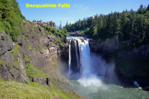 |
Snoqualmie Falls One of Washington State's most popular scenic attractions, Snoqualmie Falls is a 270 foot waterfall surrounded by a two-acre park, with an observation deck and Lodge. This is by far the most famous waterfall in Washington, receiving more visitors than almost any other single natural feature in the state. |
The next days flight is from Lewiston to Great Falls Montana in the Citation Longitude business jet. |
|
 |
Lewiston was founded in 1861 in the wake of a gold rush which began the previous year near Pierce, northeast of Lewiston. |
 |
|
This is the flight from Great Falls Montana to Sheridan Wyoming on the 30/6/21 in the Citation Longitude business jet. |
|
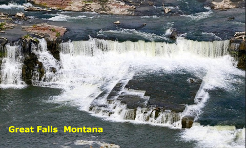 |
Great Falls straddles the Missouri River and is known as the "Electric City" because of its numerous dams and power plants. Great Falls is a community with grand traditions, rich history and superb recreational and cultural amenities. It is named for a series of five waterfalls located on the Missouri River north and east of the city and is home to the headquarters of the Little Shell Chippewa tribe, and has the largest urban Native American population in Montana, with several tribes represented. As the first people in this region, many Native American historic, and cultural sites are present in Great Falls and the surrounding area. |
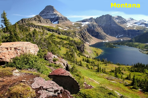 |
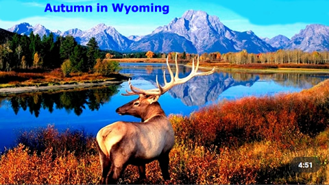
Montana is slightly larger than Japan. It is the fourth-largest state in the United States after Alaska. There's gold – and more – in those hills. Rich deposits of minerals, including gold, silver, copper, lead, zinc, coal and oil, earned Montana its nickname as the Treasure State. Montana has a large population of grizzly bears. |
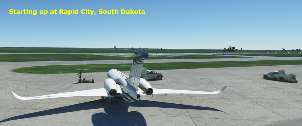
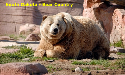
This is the flight from Sheridan to Rapid City South Dakota on 1/7/21 in the Citation Longitude business jet. |
|
 |
|
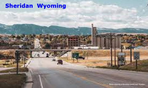 |
Sheridan, Wyoming is located at an elevation of 3,743 feet in Goose Creek Valley in the north-central part of the state. The city is in the Tongue River watershed ten miles north and east of the Big Horn Mountains, in the ancestral homeland of the Crow people. The city was named after General Philip Sheridan, Union cavalry leader in the American Civil War. Several battles between US Cavalry and the Sioux, Cheyenne, Arapaho, Shoshone, and Crow Indian tribes occurred in the area in the 1860s and 1870s before the town was built. |
 |
Wyoming's western half is mostly covered by the ranges and rangelands of the Rocky Mountains, while the eastern half of the state is high-elevation prairie called the High Plains. It is drier and windier than the rest of the country, being split between semi-arid and continental climates with greater temperature extremes. |
This is the flight from Rapid City to Sioux Falls on 2/7/21 in the Citation Longitude business jet. |
|
 |
|
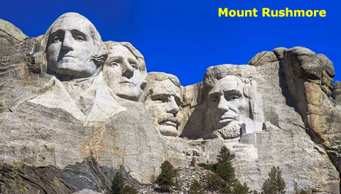 |
Mount Rushmore is located near Rapid City. Majestic figures of George Washington, Thomas Jefferson, Theodore Roosevelt and Abraham Lincoln, carved into the granite rock face, surrounded by the beauty of the Black Hills of South Dakota, tell the story of the birth, growth, development and preservation of this country. The creation of Mount Rushmore is a story of struggle — and to some, desecration. The Black Hills are sacred to the Lakota Sioux, the original occupants of the area when white settlers arrived. ... In the Treaty of 1868, the U.S. government promised the Sioux territory that included the Black Hills in perpetuity. |
 |

|
End of Part 1 |
|